Cycling the EuroVelo 6: Atlantic to Black Sea Guide
EuroVelo 6 has gotten complicated with all the inspirational fluff flying around. Every travel blog frames it as some epic, life-altering odyssey — which, fine, it can be — but nobody actually tells you which bits are paved, when the surface turns to rubble, or why you’ll probably ride one segment and call it a year. I spent eight weeks on this route last summer. Not the full 4,450 kilometres, but enough of it to stop romanticising and start taking notes.
Today, I’ll share it all with you.
The route runs from Nantes on France’s Atlantic coast to Constanța on Romania’s Black Sea shore. Ten countries. Four river corridors — the Loire, the Rhine, the Main, the Danube. One genuinely transformative cycling experience, if you go in with accurate expectations instead of Instagram ones.
Probably should have opened with this section, honestly: almost nobody rides the whole thing as one continuous journey. The route breaks naturally into standalone expeditions. Some cyclists spend two weeks on the Loire Valley. Others give their entire summer to the Danube between Passau and Budapest. That’s not failure. That’s how EuroVelo 6 actually functions as a living cycling network.
What the EuroVelo 6 Route Actually Covers
But what is EuroVelo 6, really? In essence, it’s a signed, mapped, multi-country cycling corridor following river valleys across Europe from the Atlantic to the Black Sea. But it’s much more than that — it’s four completely different trips stitched together under one name, each with its own infrastructure, its own surface conditions, its own personality.
It starts in Nantes and follows the Loire eastward through some of France’s most rideable terrain. Then it cuts toward the Rhine, traces that north into Switzerland, and pivots at Basel to follow the Main River southeast through Germany. Near Bamberg, the Main feeds the Danube — and that’s where EuroVelo 6 becomes genuinely famous.
The Danube corridor runs from Passau in Bavaria all the way to Constanța. It’s the spine. The section that floods every cycling Instagram feed. And for good reason — it’s paved, well-marked, and socially optimised. Guesthouses cater specifically to touring cyclists. The infrastructure assumes your arrival.
The western sections from Nantes to Basel? Equally legitimate, but quieter. Fewer cyclists, less predictable accommodation, less polished signage. The eastern sections through Serbia, Romania, and Bulgaria require different equipment and different expectations entirely. Not worse. Just grittier. Less refined. That’s what makes the eastern Danube endearing to us long-distance riders — it hasn’t been packaged for consumption yet.
So, without further ado, let’s dive in.
Breaking the Route Into Manageable Segments
Segment One: The Loire Valley (Nantes to Nevers)
Distance: approximately 340 kilometres. Comfortable daily pace sits around 70 kilometres, so budget five to six days. Surface is mostly asphalt — modern, maintained, occasionally broken up by packed gravel stretches. Beginner-friendly in terms of grades, though basic navigation confidence is genuinely necessary.
The Loire Valley section showcases French cycling infrastructure at its most accessible. Dedicated cycle paths run for long stretches, especially between Nantes and Angers. I covered this section in spring and found April weather genuinely unpredictable — rain, then sun, then thick mist rolling off the river by late afternoon. The landscape rolls gently. Accommodation ranges from €45 small hotels to family-run guesthouses where the owner brings breakfast to your room unannounced.
One practical note: official signage improves dramatically after you leave Nantes itself. The first 30 kilometres can feel confusing — I stopped twice trying to verify intersections. Download the Komoot route before departure. Not as backup navigation. Use it as your primary wayfinding system from day one.
Segment Two: Central Europe (Basel to Passau)
Distance: approximately 450 kilometres. Six to seven days. Surface runs predominantly asphalt with excellent signage. Intermediate difficulty — this is where the route transitions from French tourist cycling to something more serious.
Basel to Passau crosses Switzerland, Germany, and the upper Rhine and Main valleys. The Rhine section is superb — paved, fast, relatively flat. Around Bamberg, you notice the landscape shifting. The architecture changes. The light changes. You’re entering Central Europe properly, and it feels like a threshold.
Critical planning detail here: accommodation becomes sparse. Smaller towns don’t always have tourist infrastructure geared toward cyclists. Book guesthouses the evening before, or use Warmshowers — a peer-hosted network connecting touring cyclists with local hosts — to cover gaps. Summer weekends mean camping sites fill by mid-afternoon. Don’t make my mistake of rolling into a village at 6pm assuming something will materialise.
Segment Three: Upper Danube (Passau to Budapest)
Distance: approximately 950 kilometres. Thirteen to fourteen days. Surface is nearly 95% asphalt, extremely well-maintained. Difficulty runs easy to intermediate — mostly flat with occasional gentle grades. This is the golden segment.
Passau marks where the Danube begins in earnest, and here the route transforms into something almost mechanically perfect. The Donauradweg — the Danube Cycle Path — is the most developed, most maintained, most crowded section of EuroVelo 6. Paved. Signed. Predictable. Daily distances range from 60 to 90 kilometres depending on your legs.
By midsummer, crowds are substantial, particularly between Vienna and Melk. If solitude matters to you, ride this section in May or September. If community matters — if you want the social energy of dozens of touring cyclists converging on the same riverside gasthaus at 5pm — July is your month.
Accommodation is everywhere and inexpensive by Western European standards. I stayed in family pensions, small hotels, and two excellent camping sites — one near Krems, one near Gonyu. None cost more than €35 per night, breakfast included. Book two or three days ahead rather than same-day to find the better options before other cyclists snap them up.
Segment Four: Lower Danube (Budapest to Constanța)
Distance: approximately 1,200 kilometres. Sixteen to eighteen days. Surface is mixed — paved roads alternating with gravel, dirt tracks, and rough surfaces. Intermediate to challenging difficulty. This segment demands different equipment and a fundamentally different mindset.
From Budapest eastward through Hungary, Serbia, Romania, and Bulgaria, you leave the developed Donauradweg infrastructure behind. Signage becomes inconsistent. Villages are smaller and less prepared for tourists. The river is still your guide, but you’re reading it rather than following arrows.
Between Budapest and the Iron Gates — the dramatic canyon section between Serbia and Romania — expect reasonably good asphalt. Beyond the Iron Gates, through Djerdap National Park and into Romania and Bulgaria, the surface deteriorates dramatically. I encountered stretches of pure dirt, rutted farm tracks, crumbling tarmac. My Schwalbe Tough Tom tyres at 32mm width felt narrow here. Locals running bikepacking trips typically run 45–50mm tyres with aggressive tread — and you’ll understand why immediately.
A puncture in rural Bulgaria means a potential 15-kilometre walk to the nearest repair shop. Weather damage affects these roads rapidly. This section separates experienced touring cyclists from casual riders — not because the grades are punishing, but because the unpredictability accumulates over days.
Which Sections Are Paved and Which Are Not
The western sections — Loire to Basel — are paved. Essentially all of it. Modern, smooth, maintained asphalt. Central Europe from Basel to Passau runs about 95% paved, with brief gravel sections around the Main Valley that feel intentional rather than neglected.
The Upper Danube from Passau to Budapest is almost entirely paved. I rode 940 kilometres and encountered perhaps 15 kilometres of loose gravel, all signed clearly and rideable on 28mm tyres without incident.
Then everything changes at Budapest.
The Lower Danube runs roughly 60% paved asphalt, 25% compacted gravel, 15% dirt and rough surfaces. In Serbia and Romania especially, the route degrades into something barely maintained. Spring flooding affects these roads substantially. I rode through a section near the Iron Gates where erosion had literally shifted the road surface.
For tyres: 28–32mm works fine through western and Upper Danube sections. Once you commit to Hungary eastward, move to 35mm minimum — preferably 40mm or wider. A gravel-capable bike becomes practically essential beyond the Iron Gates. I’m apparently a 40mm tire person and my Trek Checkpoint ALR works for me, while my old road bike never handled the eastern sections at all. Don’t make my mistake of packing light and optimistic.
Surface conditions also shift seasonally. Late spring often reveals potholes and erosion from winter freeze-thaw cycles. Mid-summer offers the most stable riding, though heat becomes brutal in the south. September typically presents ideal conditions — firmer ground, cooler temperatures, manageable crowds.
Best Time of Year to Cycle EuroVelo 6
May through September frames the legitimate riding season. Outside that window, you’re fighting weather volatility or outright danger.
May is excellent for the western sections. Loire Valley cycling in May feels almost perfect — cool mornings, warm afternoons, green everything, wildflowers along the towpath. The Danube at this time attracts far fewer cyclists than summer. Accommodation in smaller towns remains available. Rainfall is moderate but real.
June transforms the Upper Danube into peak season. Guesthouses book weeks ahead. Prices creep upward. Weather is stable and warm. If you’re targeting the Passau-to-Budapest segment, June works perfectly — predictable conditions and the genuine psychological boost of riding alongside other long-distance cyclists.
July and August bring heat that genuinely punishes inexperienced riders, particularly in the Balkans. Temperature records show 38–40°C in southern Serbia and Bulgaria during peak summer. You ride early morning and late afternoon, rest through midday. Water becomes a logistical concern — small villages sometimes lack reliable stores. I made the mistake of riding the Bulgaria section in mid-July and spent three days exhausted and sunburned despite SPF 50 applied religiously. That was a hard lesson.
September is honestly the ideal month. Heat has broken. Crowds have vanished after Labour Day. Accommodation is abundant and cheaper. The Danube is peaceful. Eastern European roads have settled after spring flooding. I’d recommend planning any Lower Danube section specifically for September if your schedule allows it.
April is viable for western sections only — beyond that, unpredictable weather and minimal infrastructure make it a gamble. October onwards means temperature drops, increasing rain, and reduced daylight. Serious cyclists can push into November, but you’re accepting cold mornings and wet equipment daily.
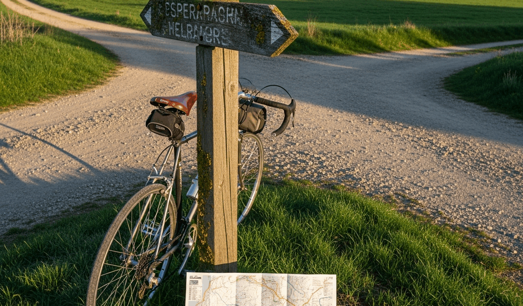
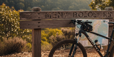
Planning Tools, Maps, and Navigation for EV6
While you won’t need a professional logistics team, you will need a handful of reliable tools — and knowing which ones actually work matters more than having all of them.
First, you should check eurovelo.com — at least if you want accurate baseline route data and contact information for regional tourism boards. It’s not a navigation tool. It’s a starting point.
Komoot might be the best option for actual turn-by-turn navigation, as EuroVelo 6 requires consistent wayfinding across ten countries. That’s because the app incorporates user comments about surface conditions and recent damage reports — which proved invaluable through the eastern sections where official signage disappears mid-route.
For the Danube specifically, the Bikeline Donauradweg guidebook series — separate volumes for Austria, Slovakia, Hungary — remains the standard resource. Paper guidebooks with detailed maps, accommodation listings, and cultural context. I carried the Austria and Hungary volumes, both priced around €14 each, and referenced them constantly during evening planning. Not necessary if you’re fully comfortable with digital mapping, but genuinely useful for the details no app captures.
GPX track files downloaded from online cycling communities can be unreliable — especially for eastern sections. I encountered several routes that deviated from the actual signed path or included discontinued roads. Cross-reference any GPX file with official EuroVelo signage and local cycling associations before committing.
Accommodation planning differs sharply by region. Western sections respond well to Booking.com. The Upper Danube works fine with the same — book five to seven days ahead during June and July. For the Lower Danube, digital booking becomes less reliable. Email regional tourism boards directly, or use Warmshowers to connect with local hosts who understand what touring cyclists actually need at the end of a long day.
Final note: download offline maps before entering areas with spotty connectivity — rural Serbia, Romania, and Bulgaria specifically. Mobile data becomes unreliable in remote stretches without warning. Offline Komoot maps or downloaded OSM files provide safety nets when signal disappears entirely and you’re standing at a dirt crossroads with no arrows in sight.


Stay in the loop
Get the latest cycle routes world updates delivered to your inbox.