What the Munda Biddi Trail Actually Is
The Munda Biddi Trail has gotten complicated with all the bikepacking hype flying around. Everyone’s posting about the East Coast or European classics, and this 1,000-kilometre beast through Western Australia just sits there, quietly humbling people who finally show up unprepared.
But what is the Munda Biddi, exactly? In essence, it’s Australia’s longest dedicated off-road cycle trail — a continuous route stretching from Mundaring, about 40 kilometres east of Perth, all the way down to Albany on the southern coast. But it’s much more than that. It’s gravel, compacted earth, sand patches that’ll stop you dead if you lose momentum, and the occasional sealed section that feels like a gift from the cycling gods after days grinding rough ground.
Most riders finish in two to six weeks. That range depends entirely on fitness, bike setup, and how hard you’re willing to push daily. I’ve met people who crushed it in 14 days flat. Others stretched to 45. Both walked away with something real.
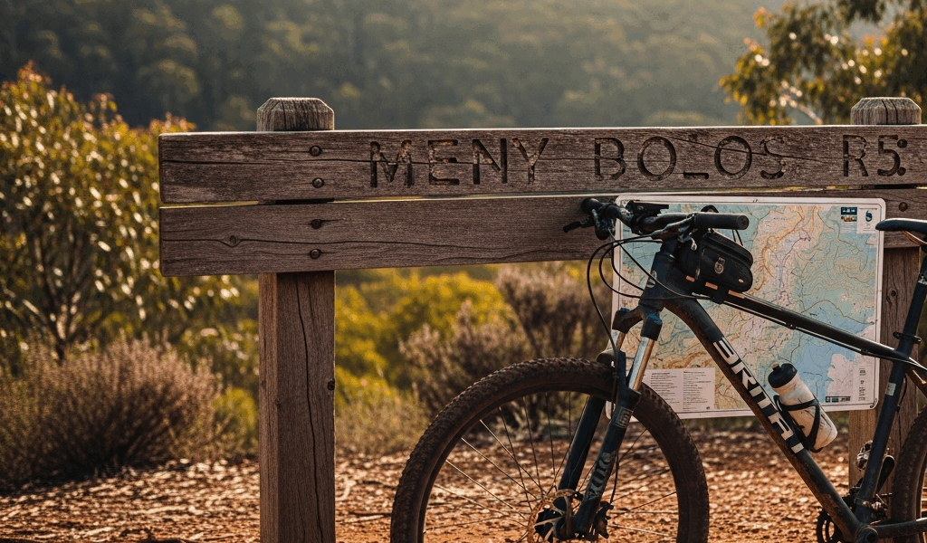
What genuinely sets this trail apart is the managed hut system — roughly 30 timber shelters spaced along the route, each with bunks, water tanks, and pit toilets. You book through the Munda Biddi Trail Foundation in advance. This changes the entire logistical equation. No hunting campsites at dusk. No guessing about water. Resupply points cluster naturally around hut locations. It’s structured without feeling like a theme park.
Probably should have opened with this section, honestly. The trail suits riders who want genuine remote riding without the full self-sufficiency burden of true wilderness touring. Technical skill matters less than fitness and mental toughness. These aren’t mountain-bike-grade rock gardens — it’s more about sustained grinding over uneven ground. Knowing your actual fitness baseline before you clip in beats discovering 200 kilometres in that you’ve badly misjudged the demands.
Breaking Down the Four Main Sections
Section One — Mundaring to Collie (160 kilometres)
This opening stretch sets the tone without immediately breaking you. Distance-wise, it’s manageable. Character-wise, it introduces you to exactly what the trail is. You’re riding through transitional forest and farmland, climbing progressively but not dramatically, with surfaces alternating between hard-packed earth, gravel, and occasional sandy stretches that reward rhythm and good line choice.
The logistical win here is straightforward resupply — towns like Northam and Beveridge sit close enough that you’re never genuinely desperate. Water tanks at the huts are reliably full in this section. The main challenge is psychological: adjusting to off-road pace, which feels slower than road cycling even when the numbers say otherwise.
Huts space out roughly 30–40 kilometres apart, making staged riding genuinely sustainable for first-timers. Most riders spend four to five days through here. That’s a reasonable pace — not rushing, not dawdling.
Section Two — Collie to Manjimup (140 kilometres)
Everything shifts here. The landscape deepens into karri and jarrah woodland that closes tight around the trail. Surfaces get sandier and more technical. Stretches between huts grow longer. Water security stops being a background concern and becomes your primary one.
Collie is your last real town service point before a substantial gap — 140 kilometres to Manjimup with water sources limited almost entirely to hut tanks. Resupply there aggressively. Don’t make my mistake. I underestimated the sand content on my first attempt and paid for it in constant micro-corrections and legs that felt wrong by mid-afternoon.
Hut spacing averages 25–35 kilometres here. The isolation is part of the appeal if solitude is what you’re after. Weather exposure increases — the forest blocks wind but traps heat on climbs, and overheating becomes a real consideration.
Section Three — Manjimup to Pemberton (110 kilometres)
This is the technical heart of it. Terrain roughens noticeably — more rocks, steeper descents, tighter trail construction. Manjimup marks the boundary between gentler country and genuine wilderness, and the riding past it demands sharper attention and more deliberate bike handling.
The logistical crux: longest gap between resupply points on the entire trail. Manjimup has a proper supermarket — Pemberton comes 110 kilometres later. That’s realistic as a solid day’s effort or a split two-day push, but food weight planning matters here more than anywhere else. Huts in this section are excellent, well-maintained, and positioned on the most scenic stretches — but they won’t conjure supplies you forgot to pack.
Water isn’t a disaster if you trust the hut tanks, though carrying at least three litres through forest sections is worth the weight. Tanks occasionally run low during dry periods. The terrain gains and loses elevation constantly rather than building monotonously — exhausting in a different, more grinding way than the earlier sections.
Section Four — Pemberton to Albany (590 kilometres)
The long haul. At 590 kilometres, section four accounts for more than half the total distance. The scale becomes the challenge — not individual technical moments, but the relentless accumulation of days and kilometres. Gravel dominates, with sand patches and occasional sealed sections breaking the rhythm.
Landscape transitions from tall forest toward more open country and eventually coastal terrain near Albany. Towns like Walpole and Denmark appear through this section with actual shops and services — resupply becomes more manageable than it was back in section three. Realistic daily distances land around 50–80 kilometres, with some days running longer.
Water stops being a genuine concern as settlement density increases. The hut system stays reliable. What you’re actually fighting is momentum — the psychological peculiarity of pressing south week after week while the finish line seems to recede even as the GPS says otherwise. That’s what makes the Munda Biddi endearing to us long-distance riders. The challenge is rarely what you expect it to be.
Gear and Bike Setup for the Munda Biddi
Your bike matters more than most cycle touring guides will admit. A hardtail mountain bike with a suspension fork works brilliantly here — absorbs rough ground, manages sand reasonably well, and won’t rattle your fillings out over 1,000 kilometres. A rigid gravel bike also works, but every rock and root becomes a personal conversation after 500 kilometres.
Tyre width is non-negotiable. Anything narrower than 38mm will frustrate you regularly. I’m apparently a slow learner about this — I ran 35mm tyres on my first attempt, spent half the trip making constant micro-corrections through sand, then switched to 45mm Schwalbe G-One Alltrack tyres for attempt two. The difference was immediate. You roll over obstacles rather than picking around them. Worth every dollar of the $120 AUD swap.
Water carrying capacity should hit at least four litres. A three-litre Ortlieb dry bag plus a 1.5-litre frame-mounted bottle gives the flexibility you need — especially through the forest sections where hut tanks occasionally run low during dry stretches.
Shelter gear matters given the huts’ simplicity. You’re sleeping in wooden structures, not bivvying. A sleeping bag rated to 5°C handles the worst Western Australian nights. Bring a sleeping mat — the bunks are bare timber, and this isn’t optional comfort, it’s functional sleep. Huts have no heating.
For carrying gear, panniers beat frame bags here. Rough surfaces and sand sections shake everything constantly. Hardened waterproof panniers — Ortlieb or similar — handle dust and occasional water crossings without drama. Strapped-on bags gradually work themselves loose. Don’t make my mistake on that front either.
Planning Your Direction and Best Time to Ride
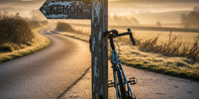
North-to-south — Mundaring to Albany — lets you ease into the trail’s rhythm through the gentler early sections. It’s also the prevailing direction, which means huts are more predictably booked and community knowledge flows more freely. South-to-north reverses that calculus entirely: you hit the technical section three immediately and finish on easier terrain when you’re already depleted. Both directions work. North-to-south is the smarter first-timer choice.
Seasonal timing isn’t optional — it’s genuinely safety-critical. Summer riding between December and February in Western Australia means temperatures regularly sitting at 35°C or above. Water scarcity spikes. Hut tanks run dry. Cyclists have abandoned the trail mid-summer due to heat management alone. Heat exhaustion on remote gravel is not a minor inconvenience.
Spring — September through November — and autumn — March through May — are the sweet spots. Temperatures sit comfortably in the 20–25°C range. Water security peaks. Riding stays challenging without becoming survival-focused. Autumn brings more moisture, which firms up sand nicely but turns clay sections slippery. Spring offers the driest conditions but occasional sharp temperature swings.
Winter riding — June through August — is doable but requires adjusted expectations. Temperatures drop to 10–15°C, with occasional frost creeping in toward the south. Daylight shrinks — finishing by 4:30 PM becomes normal. Rain frequency climbs. The huts lack heating, so sleeping bag choice matters considerably more than in milder months. Some riders actively prefer winter for the emptiness and the solitude. That was a friend of mine in 2019. She covered the whole thing in 21 days and barely saw another cyclist.
Booking runs through the Munda Biddi Trail Foundation website. Huts fill months ahead during peak season — particularly September and October. You pay a flat trail pass of roughly $200–250 AUD, plus optional hut fees typically landing around $20–30 per night. Slots for spring go fast. Book early or start refreshing pages obsessively in February.
Key Resupply Towns and Getting Off the Trail
Northam sits about 80 kilometres from Mundaring — full supermarket, population around 9,000, bike shops if you need mechanical support. It’s also the first legitimate bailout point. Getting back to Perth from here is straightforward if the trail isn’t resonating early.
Collie at 160 kilometres total has a supermarket and general supplies. This is the transition point into remote sections — so, without further ado, resupply here aggressively. The next substantial town service is 140 kilometres away, and the riding between them doesn’t forgive sloppy food planning.
Manjimup at 300 kilometres is a proper regional centre — supermarkets, a bike shop, accommodation if you need to exit or take a rest day. Logical mid-trail bailout point if circumstances shift. Frustratingly far to reach by any outside support vehicle, but it’s manageable.
Walpole at roughly 450 kilometres offers modest supplies — not a full resupply hub, but adequate for water and emergency food. It’s a brief reminder that civilisation still exists out there.
Denmark at around 520 kilometres provides the next meaningful stop, with supermarkets and services. You’re in the genuine final stretch toward Albany by this point.
Albany is the finish — coastal town, full services, accommodation, and bus transport back to Perth twice weekly. Car rental is available. The trail ends near the town centre itself, which makes the finish feel satisfyingly conclusive rather than anticlimactic.
Getting there initially: most riders fly into Perth or drive. Mundaring is 40 kilometres from the city — shuttle a vehicle or use public transport. Plan return logistics before you arrive in Albany. Don’t assume options will materialise when you’re standing there exhausted with a dirty bike.
The longest resupply gap is Manjimup to Pemberton — 110 kilometres. Carry sufficient food for that stretch and don’t rely on improvisation. The second longest is Pemberton to Walpole at roughly 95 kilometres, though intermediate hut access through that section is better than it sounds.

Stay in the loop
Get the latest cycle routes world updates delivered to your inbox.