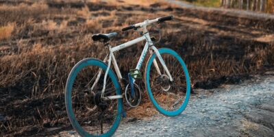
The first time I crested the Alpine Visitor Center at 11,796 feet, gasping for air in the thin Colorado atmosphere, I understood why Trail Ridge Road is considered the ultimate test for American cyclists. At 12,183 feet, this is the highest continuous paved road in the United States, and cycling its 48-mile length through Rocky Mountain National Park is an experience that pushes you to your absolute limits while rewarding you with some of the most spectacular scenery on the planet.
I’ve ridden challenging alpine routes across four continents, from the legendary cols of the Tour de France to the high passes of the Himalayas, but Trail Ridge Road holds a special place in my cycling memories. The combination of extreme altitude, unpredictable weather, and breathtaking tundra landscapes creates a ride unlike anything else in North America. That’s what makes this topic endearing to us enthusiasts.
Route Overview: America’s Rooftop Highway
Trail Ridge Road (US Highway 34) connects Estes Park on the eastern side of Rocky Mountain National Park to Grand Lake on the western slope. Here’s what you need to know before attempting this epic ride:
- Total Distance: 48 miles point-to-point
- Maximum Elevation: 12,183 feet (highest paved road in the US)
- Total Climbing: Approximately 4,000+ feet (depending on direction)
- Difficulty Rating: Expert/Extreme
- Average Grade: 5-7% on major climbs
- Road Surface: Well-maintained asphalt with periodic frost heave repairs
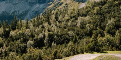
The route spends 11 continuous miles above treeline, traversing fragile alpine tundra ecosystems that took thousands of years to develop. This isn’t just a cycling route; it’s a journey through multiple climate zones, from montane forest to arctic-alpine conditions.
Best Time to Ride Trail Ridge Road
Trail Ridge Road typically opens in late May and closes by mid-October, though exact dates vary significantly based on snowpack and weather conditions. During my years of riding this route, I’ve found the optimal windows to be:
Prime Season: Mid-June to Mid-September
Mid-June to early July: The road is typically fully open, snowbanks may still line portions of the route (creating dramatic photo opportunities), and wildflowers are beginning their brief alpine bloom. Expect cooler temperatures and the possibility of afternoon snow showers even in summer.
Late July to August: This is peak season with the warmest temperatures and most stable weather patterns. However, afternoon thunderstorms are nearly guaranteed. Plan to summit before noon and begin your descent by 1 PM at the latest. Lightning above treeline is not something to take lightly.
September to early October: Crowds thin considerably, the aspen groves below treeline turn golden, and the elk rut provides unforgettable wildlife viewing. However, early snowstorms can close the road with little warning. Always check conditions before riding.
Time of Day Considerations
Start early. I cannot emphasize this enough. Begin your ride at first light, ideally between 5:30 and 6:30 AM during summer months. This strategy accomplishes several critical objectives: you’ll beat the majority of vehicle traffic, climb during cooler morning temperatures, and most importantly, clear the exposed alpine sections before afternoon thunderstorms develop.
Detailed Segment Breakdown
Segment 1: Estes Park to Many Parks Curve (10 miles)
Probably should have led with this section, honestly. The adventure begins in the charming mountain town of Estes Park at approximately 7,500 feet elevation. After entering Rocky Mountain National Park through the Beaver Meadows entrance, the road climbs steadily through dense ponderosa pine and Douglas fir forests.
This initial segment averages 5-6% gradient with several steeper pitches. The climbing is relentless but manageable as your body begins adjusting to the altitude. Watch for wildlife; I’ve encountered elk, mule deer, and even black bears on this section during early morning rides.
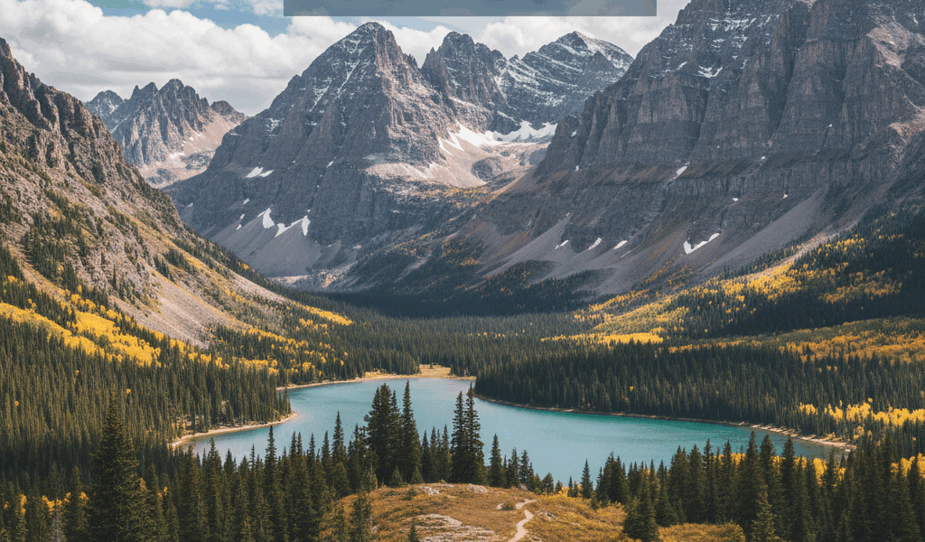
Many Parks Curve (9,620 feet) provides your first panoramic viewpoint and an excellent rest stop. The “many parks” refer to the glacial valleys visible below, including Moraine Park and Horseshoe Park.
Segment 2: Many Parks Curve to Rainbow Curve (4 miles)
The gradient intensifies as you climb above 10,000 feet. Aspen groves dominate the forest composition, and the air noticeably thins. Rainbow Curve at 10,829 feet marks the approximate treeline transition zone.
This is where many cyclists begin to feel the altitude’s effects. Your heart rate will be elevated, breathing becomes more labored, and your power output decreases significantly compared to sea-level performance. Accept this reality and adjust your pace accordingly.
Segment 3: Above Treeline to Alpine Visitor Center (7 miles)
Crossing above treeline is a transformative experience. The landscape shifts dramatically to alpine tundra, a fragile ecosystem of low-growing plants, lichens, and grasses that resembles the Arctic more than Colorado. The road winds across this vast expanse with no shelter from wind or weather.
Forest Canyon Overlook and Rock Cut provide stunning viewpoints but also expose you to the full force of mountain weather. The wind above treeline can be fierce and unrelenting, occasionally gusting to 50+ mph even on seemingly calm days.
The Alpine Visitor Center at 11,796 feet offers the only facilities along the high route. Restrooms, water, and a small gift shop are available when open. This is an essential rest stop and an opportunity to assess weather conditions before continuing to the high point.
Segment 4: High Point and Descent to Milner Pass (8 miles)
From the Alpine Visitor Center, a short but challenging climb brings you to the route’s zenith at 12,183 feet near the Lava Cliffs overlook. At this elevation, oxygen levels are approximately 60% of sea-level values. Even elite cyclists experience significant performance degradation.
The subsequent descent toward Milner Pass (10,758 feet) is technical and exposed. Wind gusts can destabilize your bike, and the road surface may have frost damage. Maintain a conservative speed and keep both hands on the bars.
Milner Pass marks the Continental Divide crossing. Water falling on the western side flows toward the Pacific; eastern precipitation drains to the Atlantic via the Gulf of Mexico.
Segment 5: Milner Pass to Grand Lake (19 miles)
The western descent is longer and more gradual than the eastern climb. You’ll pass through the Kawuneeche Valley, following the headwaters of the Colorado River. The road winds through subalpine meadows and dense spruce-fir forests before emerging at Grand Lake.
This descent requires attention despite its more moderate gradient. The road includes several climbing sections that challenge tired legs, and wildlife crossings are common in the valley bottom.
Altitude Considerations and Acclimatization
Altitude is the defining challenge of Trail Ridge Road. Even experienced cyclists with excellent fitness will struggle if they haven’t properly acclimatized. Based on my experience and consultation with sports medicine professionals, here are essential recommendations:
Acclimatization Protocol
- Arrive 2-3 days early: Spend at least 48-72 hours at moderate altitude (7,000-8,000 feet) before attempting the ride
- Stay hydrated: Drink significantly more water than you would at sea level; dehydration accelerates altitude sickness
- Avoid alcohol: Alcohol impairs acclimatization and exacerbates altitude effects
- Sleep low: If possible, sleep at lower elevation and climb high during the day
- Monitor symptoms: Headache, nausea, and unusual fatigue are warning signs of altitude sickness
Performance Expectations
Expect your power output to decrease by 15-25% above 10,000 feet compared to sea-level performance. Your maximum heart rate will be lower, and perceived exertion will be higher for equivalent efforts. This is normal physiology, not a fitness failure.
Accommodation Options
Estes Park (Eastern Terminus)
Estes Park offers abundant lodging options from budget motels to luxury resorts. For cyclists, I recommend staying near the Beaver Meadows entrance to minimize morning road travel. The Stanley Hotel, while famous for inspiring Stephen King’s “The Shining,” provides comfortable accommodations with excellent views.
Budget-conscious cyclists will find several quality options along Highway 34 and in downtown Estes Park. Book well in advance during summer months.
Grand Lake (Western Terminus)
Grand Lake is significantly smaller and quieter than Estes Park. The historic town center along the lakefront offers charming lodges and vacation rentals. Western Riviera Lakeside Lodge and Grand Lake Lodge provide comfortable post-ride recovery options.
Shuttle Logistics
Unless you’re planning an out-and-back ride (96 miles with 8,000+ feet of climbing), you’ll need shuttle transportation between Estes Park and Grand Lake. The Estes Park Shuttle provides seasonal service, or arrange private transportation through local outfitters.
Safety Considerations
Altitude Sickness
Acute Mountain Sickness (AMS) is a genuine risk above 10,000 feet. Symptoms include headache, nausea, dizziness, and fatigue. If symptoms worsen or you experience confusion, difficulty breathing, or loss of coordination, descend immediately. These could indicate High Altitude Pulmonary Edema (HAPE) or High Altitude Cerebral Edema (HACE), both life-threatening conditions.
Afternoon Thunderstorms
Rocky Mountain summer weather patterns produce thunderstorms with remarkable consistency. Convective development typically begins around 11 AM, with peak storm activity between 2 PM and 5 PM. Lightning is the primary concern; the alpine tundra offers no shelter, and you become the highest object in the landscape.
If caught in a storm above treeline, descend immediately if possible. If descent isn’t safe, move away from your bike (metal attracts lightning), crouch on the balls of your feet, and minimize contact with the ground.
Hypothermia Risk
Summit temperatures can be 30-40 degrees Fahrenheit colder than Estes Park, even in summer. Combined with wind chill and precipitation, hypothermia is a real danger on exposed descents. I’ve experienced near-freezing temperatures and snow at the summit in late June.
Wildlife Encounters
Rocky Mountain National Park is home to elk, mule deer, bighorn sheep, moose, and black bears. Maintain safe distances from all wildlife (at least 75 feet from elk and deer, 120 feet from moose and bears). Bull elk during fall rut are particularly aggressive. If wildlife is on the road, stop and wait for them to move; never attempt to ride around them.
Vehicle Traffic
Trail Ridge Road attracts significant vehicle traffic during peak season. While most drivers are respectful of cyclists, the narrow road and occasional tight corners require vigilance. Ride single file, use mirrors if available, and be predictable in your movements.
Essential Gear Recommendations
Proper gear selection can mean the difference between an epic adventure and a dangerous situation. Here’s what I carry on every Trail Ridge Road ride:
Clothing Essentials (Even in Summer)
- Wind/rain jacket: Non-negotiable; temperatures at the summit can be 40+ degrees colder than at Estes Park
- Arm and leg warmers: Easy to add/remove as conditions change
- Full-finger gloves: For descent warmth
- Lightweight vest: Additional core insulation
- Base layer: Merino wool preferred for temperature regulation
- Skull cap or ear covers: Wind at the summit penetrates even quality helmets
Nutrition and Hydration
- Water: Minimum 3 liters; refill opportunities are limited
- Electrolytes: Essential for hydration at altitude
- Calorie-dense foods: Bars, gels, and real food; plan for 4-6 hours of riding
Safety Equipment
- Cell phone: Coverage is spotty but emergency calls typically connect
- Multi-tool and spare tube: Standard cycling kit
- Sunscreen and lip protection: UV intensity increases significantly at altitude
- Emergency blanket: Compact and potentially life-saving
Comparison with Other Alpine Routes
Trail Ridge Road stands among North America’s premier cycling climbs. For cyclists seeking similar challenges, consider these comparable routes:
Going-to-the-Sun Road in Glacier National Park offers another stunning alpine traverse, though at lower maximum elevation (6,646 feet). The scenery rivals Trail Ridge Road, and the climbing is equally challenging.
For cyclists wanting to explore more Colorado alpine routes, our Mountain West Climbs guide covers additional options under 50 miles, including Independence Pass and Mount Evans Road.
The Lake Tahoe Loop provides 72 miles of alpine grandeur at more moderate elevations, making it an excellent training ride before attempting Trail Ridge Road.
Final Thoughts
Cycling Trail Ridge Road is not about setting personal records or proving your fitness. It’s about experiencing one of America’s most spectacular landscapes from the intimate perspective that only a bicycle provides. The thin air, the vast tundra expanses, the wildlife encounters, and the sheer remoteness create a ride that stays with you long after your legs have recovered.
Prepare thoroughly, respect the mountain environment, and give yourself permission to simply absorb the experience. Trail Ridge Road will challenge you in ways that few rides can, but the rewards are equally profound.
When you finally coast into Grand Lake, having crossed the Continental Divide at the roof of America, you’ll understand why so many cyclists consider this the ride of a lifetime.
About the Author: This guide is based on multiple rides across Trail Ridge Road in varying conditions, consultation with Rocky Mountain National Park rangers, and ongoing research into altitude physiology and mountain weather patterns. Information current as of 2025.