
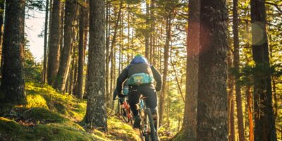
In my experience riding the Blue Ridge Parkway, there are few cycling routes in America that offer such a profound connection between challenging terrain and breathtaking natural beauty. Over the course of multiple trips spanning different seasons, I’ve come to understand why this 469-mile ribbon of road through the Appalachian Mountains holds a special place in the hearts of serious cyclists. This comprehensive guide draws from countless hours in the saddle and years of accumulated knowledge to help you plan your own Blue Ridge adventure.
Route Overview: America’s Favorite Scenic Drive on Two Wheels
The Blue Ridge Parkway stretches 469 miles from Shenandoah National Park in Virginia to the Great Smoky Mountains National Park in North Carolina. Unlike many cycling routes that follow flat terrain or rail trails, the Parkway presents a genuine mountain cycling challenge that rewards riders with some of the most spectacular vistas in the eastern United States. That’s what makes this topic endearing to us enthusiasts.
Key Statistics
- Total Distance: 469 miles (755 km)
- Starting Point: Rockfish Gap, Virginia (Milepost 0)
- Ending Point: Cherokee, North Carolina (Milepost 469)
- Total Elevation Gain: Approximately 45,000 to 50,000 feet (varies by direction)
- Highest Point: Richland Balsam (6,053 feet) at Milepost 431
- Average Daily Climbing: 4,000-6,000 feet for a typical 10-day journey
- Difficulty Rating: Advanced to Expert (due to sustained climbing and distance)
The Parkway maintains a maximum speed limit of 45 mph, which creates a relatively cyclist-friendly environment compared to other mountain roads. However, the absence of shoulders on most sections and the winding nature of the road require constant vigilance and defensive riding.
Best Time to Ride the Blue Ridge Parkway
Timing your Blue Ridge Parkway ride can make the difference between an unforgettable experience and a challenging ordeal. Based on my multiple journeys along this route, I can offer specific guidance for each season.
Fall (September through October) – Peak Season
Fall foliage season is unquestionably the premier time to cycle the Blue Ridge Parkway. The mountains transform into a canvas of brilliant oranges, reds, and golds that must be seen to be believed. In my experience, the peak colors typically occur between mid-October and early November, though this varies by elevation. Higher elevations change earlier, so cycling north to south in early October allows you to follow the color wave down the mountains.
Advantages: Spectacular scenery, comfortable temperatures (50-70°F during the day), lower humidity, minimal insect activity.
Considerations: Peak tourism means more vehicle traffic, especially on weekends. Accommodations book months in advance. Morning temperatures can dip into the 30s at higher elevations.
Spring (Late April through May)
Spring brings wildflowers, blooming rhododendrons, and the renewal of the forest canopy. Temperatures are pleasant, though rain is more frequent than in fall.
Advantages: Fewer crowds, lower accommodation costs, beautiful wildflowers.
Considerations: Unpredictable weather, occasional section closures due to winter damage, higher elevations may still have cold temperatures.
Summer (June through August)
Summer offers the longest daylight hours and generally reliable weather, but heat and humidity can be challenging, particularly in the lower elevation sections.
Advantages: Longest days, all facilities open, most predictable weather.
Considerations: Heat and humidity (especially below 4,000 feet), afternoon thunderstorms are common, higher tourist traffic.
Detailed Segment Breakdown
Probably should have led with this section, honestly. Understanding the distinct character of different Parkway sections helps with planning your daily distances and knowing what challenges lie ahead.
Virginia Section (Mileposts 0-216.9)
The Virginia portion of the Parkway tends to have more gentle grades and slightly lower elevations than the North Carolina sections. This makes it an excellent starting point for riders heading southbound, allowing you to build fitness before encountering the more challenging terrain ahead.
Rockfish Gap to Roanoke (Mileposts 0-121)
This opening section introduces you to the Parkway’s rhythm with moderate climbing and frequent overlooks. The Peaks of Otter area around Milepost 86 offers excellent facilities including a lodge, campground, and restaurant. In my experience, this section averages 3,000-4,000 feet of climbing per day when covering 40-50 miles.
Roanoke to Virginia/North Carolina Border (Mileposts 121-216.9)
The terrain becomes more demanding as you approach the border. Mabry Mill (Milepost 176) is a must-stop attraction with excellent breakfast options. Smart’s View and Rocky Knob areas provide stunning vistas and camping options.
North Carolina Section (Mileposts 216.9-469)
North Carolina brings the serious climbing. This is where the Parkway reveals its true mountain character, with longer sustained grades and higher overall elevations.
Border to Blowing Rock (Mileposts 216.9-295)
The transition into North Carolina immediately presents challenging terrain. The Linn Cove Viaduct area near Grandfather Mountain features some of the most dramatic engineering and scenery on the entire route. Expect consistent climbing and elevations regularly exceeding 4,000 feet.
Blowing Rock to Asheville (Mileposts 295-384)
This section includes some of the Parkway’s most popular attractions, including the Folk Art Center and various craft centers. The approach to Asheville offers opportunities to resupply and enjoy the city’s renowned food and cycling culture.
Asheville to Cherokee (Mileposts 384-469)
The final section is arguably the most challenging. You’ll encounter the highest point on the entire Parkway at Richland Balsam (6,053 feet), along with sustained climbing that will test even well-trained cyclists. In my experience, this section requires careful pacing and realistic daily distance goals.
Accommodation and Logistics
Planning where to sleep each night is crucial for a successful Blue Ridge Parkway tour. Options range from primitive camping to historic lodges.
Campgrounds
The National Park Service operates nine campgrounds along the Parkway. All operate on a first-come, first-served basis for tent camping (reservations available for some sites). Key campgrounds for cyclists include:
- Otter Creek (MP 60.8): One of the larger facilities with 45 tent sites
- Peaks of Otter (MP 86): Convenient location with nearby lodge and restaurant
- Rocky Knob (MP 167): Beautiful setting in the Virginia highlands
- Doughton Park (MP 239): Excellent facilities as you enter North Carolina
- Julian Price (MP 297): Large campground near Blowing Rock
- Mount Pisgah (MP 408.6): High elevation camping with restaurant nearby
Lodges and Inns
For cyclists seeking more comfortable accommodations, several options exist directly on the Parkway:
- Peaks of Otter Lodge (MP 86): Full-service lodge with restaurant
- Pisgah Inn (MP 408.6): Stunning views at 5,000 feet elevation
- Bluffs Lodge at Doughton Park (MP 241): (Check availability as operations vary)
Many cyclists also incorporate nearby towns for resupply and accommodation. Waynesboro, Lexington, Roanoke, Boone, Blowing Rock, and Asheville all provide access to the Parkway and offer extensive services.
Resupply Points
Unlike the Natchez Trace Parkway, which passes through numerous small towns, the Blue Ridge Parkway is more isolated. Plan your food and water carefully. Major resupply opportunities occur near:
- Waynesboro, VA (near MP 0)
- Roanoke, VA (exits around MP 121)
- Floyd, VA (near MP 165)
- Boone/Blowing Rock, NC (near MP 291-295)
- Asheville, NC (multiple access points MP 382-393)
Safety Tips and Challenges
The Blue Ridge Parkway presents several unique safety considerations that every cyclist should understand before embarking on this journey.
Elevation and Weather
Weather can change dramatically and quickly in the mountains. Temperatures at 6,000 feet can be 15-20 degrees cooler than at lower elevations. I’ve experienced sunny conditions at the start of a climb that turned to fog, rain, and near-freezing temperatures at the summit.
Essential practices:
- Check weather forecasts for multiple elevations along your planned route
- Always carry rain gear and an extra warm layer
- Be prepared to alter plans if severe weather threatens
- Start early to avoid afternoon thunderstorms (common in summer)
Traffic Considerations
While the 45 mph speed limit helps, motor vehicle traffic remains the primary safety concern. The Parkway has minimal shoulders, and many drivers are distracted by the scenery.
Defensive cycling strategies:
- Use front and rear lights at all times, even in daylight
- Wear high-visibility clothing
- Take the lane when necessary, especially on curves with poor sight lines
- Avoid riding on weekends during fall foliage peak if possible
- Use mirrors to monitor approaching traffic
Tunnel Safety
The Parkway includes 26 tunnels, most in North Carolina. These present unique challenges for cyclists:
- Bright lights (front and rear) are absolutely essential
- The temperature drop inside tunnels can be significant
- Road surfaces may be wet even in dry weather
- Motorists’ eyes take time to adjust to darkness
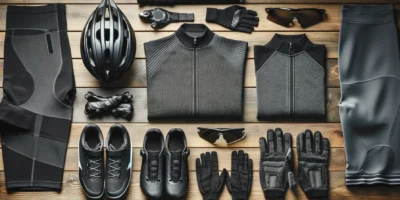
What to Pack: Essential Gear for the Parkway
Proper gear selection can make or break your Blue Ridge experience. Based on multiple through-rides, here’s what I consider essential.
Bike Setup
- Gearing: A compact crankset (50/34) with an 11-34 cassette minimum; consider a 32/11-36 or lower for loaded touring
- Tires: 28-32mm tires for comfort on the occasionally rough pavement
- Lighting: Bright front light (minimum 500 lumens for tunnels), rear light with daylight flash mode
- Mirrors: Highly recommended for monitoring traffic on winding roads
Clothing
- Layers that can handle a 40-degree temperature range
- Quality rain jacket and waterproof shoe covers
- Arm and leg warmers for temperature transitions during climbs
- High-visibility vest or jersey
- Full-finger gloves for cold descents
Emergency and Navigation
- Detailed maps or GPS device (cell coverage is unreliable)
- First aid kit with blister treatment and pain relievers
- Emergency blanket
- Sufficient cash (some Parkway facilities don’t accept cards)
- Multi-tool and spare tubes, patch kit, tire levers, mini-pump
Connecting Routes and Extended Adventures
The Blue Ridge Parkway connects with other exceptional cycling routes for those looking to extend their adventure.
At its northern terminus, riders can continue into Shenandoah National Park via Skyline Drive, adding another 105 miles of scenic mountain cycling. The combined Blue Ridge Parkway and Skyline Drive total nearly 575 miles of continuous scenic parkway riding.
For a different style of adventure, the Great Allegheny Passage offers a car-free rail trail experience through Pennsylvania and Maryland. While the terrain and riding style differ dramatically from the Parkway, many cyclists combine these routes for an extended Eastern Seaboard tour.
The Natchez Trace Parkway provides a southern counterpart with its own unique character, gentler grades, and rich historical significance. Some ambitious cyclists tackle both parkways in a single extended tour.
Final Thoughts
The Blue Ridge Parkway demands respect and preparation, but it rewards cyclists with an unparalleled journey through some of America’s most beautiful mountain scenery. In my experience, success on this route comes from careful planning, realistic daily goals, and maintaining flexibility when weather or fatigue requires adjustment.
Whether you tackle the entire 469 miles or focus on a particular section, the Blue Ridge Parkway offers cycling memories that will last a lifetime. The combination of challenging terrain, stunning vistas, and the satisfaction of conquering genuine mountain roads makes this one of America’s truly great cycling adventures.
Take your time, prepare thoroughly, and embrace both the challenges and rewards that await along “America’s Favorite Drive.”
Stay in the loop
Get the latest wildlife research and conservation news delivered to your inbox.