Best Gravel Cycling Routes in the Pacific Northwest
PNW gravel has gotten complicated with all the “hidden gem” listicles flying around — everyone’s got a hot take and half of them have never actually ridden here in November. As someone who relocated to the Pacific Northwest six years ago and promptly spent two full seasons getting everything wrong, I learned everything there is to know about what these roads actually demand. Wrong tires, wrong timing, a genuinely embarrassing misunderstanding of what locals mean when they say “light rain.” What follows is the real picture — organized by region, with the kind of detail I wish someone had handed me when I was eating mud on a Forest Service road outside North Bend wondering what, exactly, had gone sideways.
These aren’t every route worth riding. They’re the ones I keep coming back to — the ones I text to visiting riders at 11pm when they ask where to go. Open agricultural country, dense fir forest, river canyon riding. I’ve included GPS notes where they matter, honest surface condition breakdowns, and timing advice, because out here, timing is most of the battle.
The Palouse — Eastern Washington
Stumbling onto the Palouse for the first time feels like someone picked up the Midwest and improved it substantially. Rolling wheat fields stretching to the horizon, county roads connecting small towns that still have grain elevators and diners serving coffee in ceramic mugs — not paper, ceramic. You can see your route from a ridgeline. Twenty miles of it, just unspooling across the hills. I did my first Palouse loop in September 2019 and started planning the return trip before I’d even unloaded my bike from the car. That’s what makes the Palouse endearing to us gravel cyclists — it rewards the long view, literally.
Route Overview and Distance
The classic starting point is Pullman, Washington — home of WSU and a decent coffee situation on Grand Avenue if you poke around near the blue awnings. From Pullman, most riders string 60 to 80-mile loops using county road 7700 and the roads north toward Palouse and Garfield. Surface types shift constantly: packed gravel to chip seal to honest dirt, sometimes within a single mile. A GPX-capable computer is non-negotiable here. Cell service disappears completely in the wheat fields between Garfield and Tekoa — no warning, just gone.
Elevation catches people off guard. These aren’t flat plains. Ancient loess hills, and the roads roll in a way that quietly accumulates 4,000 to 5,500 feet of climbing in an 80-mile day before you’ve noticed it happening. Don’t make my mistake — I was running a 1x drivetrain with a 40t chainring and an 11-42 cassette on my Salsa Warbird, which worked, but barely. If you’re not a strong climber, run a wider rear cassette or just accept that the last 20 miles will be a character-building experience.
Timing — June and October Are the Windows
June before harvest and October after it are the two windows that matter. June gives you green fields and temperatures in the 60s to low 70s. October strips everything down and turns the landscape gold and enormous against the sky. Both are correct answers. July and August are rideable but hot — 90°F days happen regularly, and there’s almost no shade on these roads. March and April are technically possible. Also frequently miserable, with mud that packs into fenders and stops wheels from turning mid-descent. I’ve done it. Would not recommend.
Lodging: the Nendels Inn in Pullman runs $85 to $110 a night and has a parking lot big enough to unload a bike rack without performing a 12-point turn. The Hampton is also there and costs more for roughly the same result.
Tiger Mountain Loop — Seattle Area
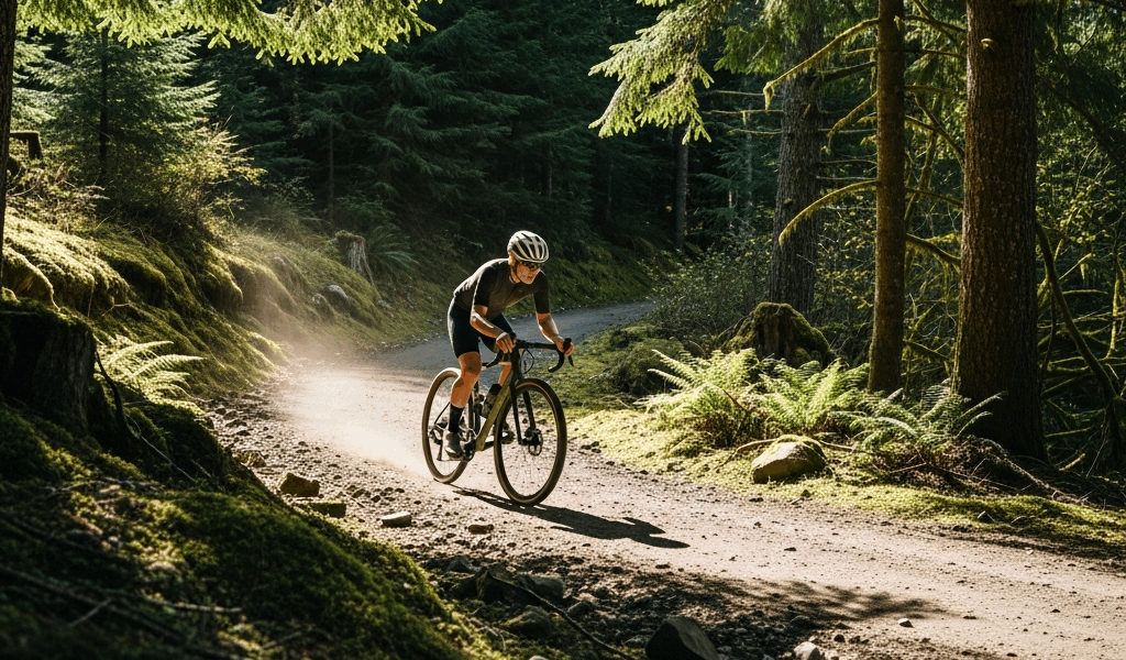
Probably should have opened with this section, honestly, since it’s the most accessible route here for anyone based in or visiting Seattle. Tiger Mountain sits about 20 miles east of the city in the Issaquah Alps — USFS roads lace through the forest in a way that’s been quietly beloved by the local gravel community for years. The trail network gets heavy mountain bike and hiker traffic, but the forest roads themselves — maintained gravel and dirt fire roads — stay wide open and almost always quiet.
Getting There and Route Shape
You can drive to the Tiger Mountain State Forest trailhead off SR-18 and start from the parking area. Or — and this is the better option if you’re staying in Seattle — ride the Burke-Gilman Trail out to Issaquah and build the whole thing into a 50-mile door-to-door day. The loop itself, using West Side Road and the forest roads east of it, runs 35 to 50 miles depending on which connectors you include, with 3,000 to 5,000 feet of elevation again depending on your choices.
Surfaces are mixed. Main USFS road corridors are packed gravel and drain reasonably well even after rain. The doubletrack connectors through the upper forest get chunky and loose in spots. I run 700x40mm tires on most routes out here — Tiger Mountain is the one place I’ve seriously considered going to 42mm or 45mm. The Panaracer GravelKing SK in 40mm handles it fine. The WTB Riddler 37mm does not — too narrow, knobs aren’t aggressive enough for the upper road conditions in November.
Elevation and What to Expect
The climbing on Tiger Mountain is not subtle. Main ridge roads push up sustained grades — nothing technical, but 8% to 12% on loose gravel that punishes anyone who attacks the pitch rather than sitting and spinning through it. On clear days, views open toward Rainier to the southeast and the Olympics to the west. Foggy days — common — are their own thing entirely. Trees close in on the descent back to Issaquah, the road narrows, and you earn every one of those miles. Best months are May through June and September through early November.
One detail worth knowing: the USFS gate on the upper road near the radio tower closes sometimes on weekdays for maintenance. No consistent schedule I’ve ever been able to find. It’s happened to me twice — once on a Tuesday in October, once on a Thursday in May. Just be prepared to reroute or turn back.
Columbia River Gorge — Oregon Side
Frustrated by years of watching the Oregon side of the Gorge get completely ignored in cycling media, I put together a proper route profile for this area in spring 2022 using a spiral notebook and a laminated county road map I bought at a gas station in Hood River for $4. It immediately became one of my most-ridden routes. The Washington side gets the attention — the Historic Columbia River Highway is gorgeous and well-documented — but the Oregon side’s gravel roads through the cherry and pear orchards above Hood River are something else entirely.
The Route — Hood River to Mosier and Beyond
Starting in Hood River and heading east, you climb out of town on gravel roads through orchards toward Mosier, connect with the Cherry Heights Road network, then hit the ridge roads above the Gorge. Main loop distance runs 50 to 70 miles depending on your extensions — 4,500 to 6,500 feet of climbing. Views down into the Columbia are extraordinary. Wide open, with Rainier and Hood framing the scene on clear days. But what is the Cherry Heights loop? In essence, it’s an orchard ridge traverse above the Gorge. But it’s much more than that — it’s one of the few places in the PNW where high desert and temperate forest collide mid-ride.
Surfaces are mostly packed gravel county roads maintained by Hood River and Wasco Counties, mixed with chip seal connectors and stretches of honest dirt. Agricultural traffic runs heavy in June and July — flatbed trucks moving harvest equipment. Early morning starts make sense during peak cherry harvest. Mid-May, though, is absurdly beautiful — blossoms everywhere, almost no traffic. That’s the ride I keep returning for. Start at 7am from Hood River, climb to Cherry Heights, come back on the Rowena Plateau roads, descend into Mosier, stop at the diner for pie, ride back along the Historic Highway. Call it 58 miles. It’s close to perfect.
Logistics and Road Notes
Hood River has excellent cycling infrastructure. Discover Bicycles on Oak Street handles tube swaps and quick mechanic stops without making you feel bad about it. Gorge Transload near the waterfront works as a parking start point. Wind is the major variable — the Gorge funnels westerlies through the canyon hard, and a headwind on the return leg can turn an easy last 15 miles into a genuine sufferfest. Check the Hood River weather station before you go. Anything over 15mph from the west, mentally add 45 minutes to your return time. Probably more.
I flatted above Rowena once on chip seal debris — pinch flat, not a thorn — and spent 20 minutes finding a signal strong enough to figure out where I actually was. Carry two tubes and a pump. CO2 cartridges and cold Gorge air don’t always cooperate the way you want them to. That’s a lesson that costs you 40 minutes on a canyon wall if you learn it the wrong way.
Seasonal Tips for PNW Gravel
The Pacific Northwest does not behave like one climate — and this trips up visiting riders constantly. Eastern Washington, the Palouse specifically, is semi-arid high desert. Cold winters, hot summers, limited rain. The west side — Tiger Mountain, the Seattle area — is temperate rainforest, wet from October through May, briefly dry from July through September. The Gorge runs its own microclimate driven by pressure differentials between the coast and the high desert. These places require different preparation in different months. Treat them the same and you will suffer appropriately.
Rain Gear — What Actually Works
A Showers Pass Elite 2.1 jacket — around $280 — is the benchmark for west-side riding. Waterproof enough to handle a full day in rain without soaking through, breathable enough you don’t cook on the climbs. Pearl Izumi AmFIB Lite bib tights at around $200 handle the bottom half. Cheaper alternatives exist. All of them fail in sustained heavy rain above 2,000 feet. I’ve tested this extensively and involuntarily — the Gorge in October teaches fast.
Fenders are not optional on the west side. SKS Raceblade Pro XL in 45mm clearance fits most gravel bikes running 40mm tires. Without fenders you’re covered in wet grit within 10 minutes of a damp road — and this isn’t a comfort complaint. Grit in your eyes on a descent is dangerous. Grit in your drivetrain every ride destroys components in a single season. Both things are true.
Mud Tires — When and Which Ones
November through March on the west side — and shoulder seasons everywhere — mud tires make a real difference. The Teravail Cannonball 700x42mm might be the best option, as PNW gravel requires serious mud clearance. That is because the loam here doesn’t compact and shed the way eastern dirt does — it clumps, packs, and stays. The WTB Venture 700x40mm is a close second and slightly faster on packed gravel when things dry out. Run tubeless with Stan’s Race Sealant at 28 to 32psi front and 30 to 35psi rear for a 160-pound rider. Go lower if you’re lighter, higher if you’re loaded up.
Best Months by Region — A Straight Answer
- Palouse (Eastern WA): June and October. Full stop.
- Tiger Mountain (Seattle Area): May–June and September–October. July and August work but get busy with hikers.
- Columbia River Gorge (Oregon Side): Mid-May for blossoms, September for harvest light, October for fall color. Avoid peak summer heat in July–August above 1,500 feet.
- General West Side: July and August are your reliable dry window. Everything else requires acceptance of rain and the right gear to handle it.
One More Thing Worth Knowing
Navigation apps matter more in the PNW than almost anywhere else. Cell service drops on forest roads, agricultural roads, and canyon walls — no warning, just a blank screen. Download your routes offline before you leave. Ride with GPS in offline mode. Komoot handles PNW gravel routing better than Strava in my experience — surface type data is more accurate, and the elevation profiles are more honest about what’s actually on the road versus what satellite imagery suggests might be there. That difference matters when you’re deciding between two connectors at mile 45.
The PNW gravel scene has grown enormously over the last five years — but these roads still feel quiet compared to the organized chaos of California or Colorado gravel events. That’s what makes the PNW endearing to us gravel cyclists who’ve ridden both. These roads stay open because farmers and land managers haven’t had reason to close them. Respect the access, pack everything out, close the gates you find closed. It’s a small thing that keeps a good thing going.


Stay in the loop
Get the latest cycle routes world updates delivered to your inbox.