
Standing at the edge of the Hogsback ridge, with sheer 1,000-foot drops on either side and nothing but red rock wilderness stretching to the horizon, I realized why Utah Scenic Byway 12 is considered one of the most spectacular cycling routes in the world. This is not just a bike ride; it is a journey through 170 million years of geological history, a test of physical endurance, and an experience that will fundamentally change how you think about cycling.
As a cyclist who has pedaled through mountain passes across four continents, I can say without hesitation that Byway 12 offers something genuinely unique. The combination of dramatic elevation changes, otherworldly landscapes, and the sheer remoteness of the route creates an adventure that belongs on every serious cyclist’s bucket list. But make no mistake: this route demands respect, preparation, and a willingness to push beyond your comfort zone.
Route Overview: Numbers That Tell a Story
Utah Scenic Byway 12 stretches 124 miles from Torrey in the north to Panguitch in the south, connecting three of Utah’s most iconic landscapes: Capitol Reef National Park, Grand Staircase-Escalante National Monument, and Bryce Canyon National Park. The All-American Road designation, the highest recognition granted to American scenic byways, only hints at what awaits cyclists brave enough to tackle this route.
The statistics alone reveal the challenge ahead:
- Total Distance: 124 miles (approximately 200 kilometers)
- Total Elevation Gain: Over 10,000 feet (3,048 meters)
- Highest Point: 9,400 feet near Boulder Mountain
- Difficulty Rating: Challenging to Advanced
- Recommended Riding Days: 2-4 days depending on fitness and pace
- Services: Extremely limited, with gaps of 30+ miles between towns
Unlike popular cycling routes with regular support services, Byway 12 passes through some of the most remote terrain in the lower 48 states. Cell phone coverage is spotty at best, and certain stretches offer no services, shade, or water sources for extended distances. This isolation, while part of the route’s appeal, requires serious logistical planning.
Best Time to Ride: Timing is Everything
The window for cycling Byway 12 is surprisingly narrow. Summer heat in the desert sections regularly exceeds 100 degrees Fahrenheit, while early spring and late fall can bring snow and freezing temperatures at the higher elevations. Two optimal windows exist for tackling this route:
Late May Through Mid-June
This spring window offers comfortable temperatures in the 70s and 80s, longer daylight hours, and wildflowers blooming across the high desert. Snow may still linger on Boulder Mountain, but the road is typically clear. Water availability from seasonal streams is at its best during this period. The main drawback is the potential for late spring storms, which can drop temperatures rapidly and create dangerous conditions on exposed ridges.
Late September Through Mid-October
The fall window provides perhaps the most spectacular riding conditions. Summer heat has broken, aspens are turning gold on the mountain slopes, and the lower sun angle creates dramatic lighting for the red rock formations. Temperatures range from the 50s at higher elevations to the 70s in the valleys. Tourist traffic has diminished, meaning fewer RVs on the narrow sections. However, days are shorter, and early snowfall is always possible at elevation.
I completed my ride in early October and found the conditions nearly perfect, with crisp mornings that warmed into comfortable afternoon temperatures. The lack of summer crowds meant I often had the most dramatic viewpoints entirely to myself.
Detailed Segment Breakdown
Segment 1: Torrey to Boulder (32 miles)
The journey begins in Torrey, a small town at the western edge of Capitol Reef National Park. Starting elevation is approximately 6,850 feet, providing a relatively cool morning start. The first miles pass through the Fremont River valley, with views of the park’s dramatic Waterpocket Fold formation to the east.
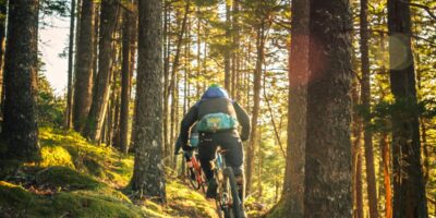
The real climbing begins as you leave the valley floor and start ascending Boulder Mountain. Over the next 20 miles, you will gain approximately 3,200 feet of elevation, reaching over 9,400 feet at the summit. This is the most sustained climbing on the entire route, and the alpine environment provides welcome relief from the desert heat below. Dense forests of pine, spruce, and aspen line the road, and wildlife sightings are common.
The descent into Boulder is technical and fast, dropping roughly 2,000 feet in 12 miles. The road surface is generally good, but watch for gravel patches on curves. Boulder itself offers limited services but has gained a reputation for farm-to-table dining at Hell’s Backbone Grill, making it an excellent overnight stop.
Segment 2: Boulder to Escalante (28 miles)
This segment contains the most dramatic scenery on the entire route. Leaving Boulder, you immediately enter the slickrock wilderness of Grand Staircase-Escalante National Monument. The famous Hogsback section comes early, a narrow ridge with precipitous drops on both sides and no guardrails to diminish the experience.
The Hogsback demands full concentration. Wind gusts can catch you off guard, and the psychological challenge of pedaling along a knife-edge ridge tests even experienced cyclists. Take your time here, stop at the pullouts to absorb the views, and consider walking your bike if conditions feel unsafe.
After the Hogsback, the route descends into the Escalante River drainage through Calf Creek Canyon. This section features dramatic canyon walls and access to the popular Lower Calf Creek Falls trail, a 6-mile round trip hike to a 126-foot waterfall. The road then climbs back out of the canyon before the final descent into Escalante.
Escalante is the largest town between Torrey and Panguitch, with multiple food options, a well-stocked grocery store, and several lodging choices. For cyclists planning to complete the route over multiple days, Escalante is the logical midpoint stop.
Segment 3: Escalante to Bryce Canyon Area (64 miles)
The final and longest segment crosses the eastern edge of the Grand Staircase before climbing to Bryce Canyon and descending to Panguitch. Leaving Escalante, the road crosses high desert terrain with expansive views and minimal shade. This section is particularly exposed to afternoon heat during summer months.
The route passes through the small towns of Henrieville and Cannonville before reaching the junction with Highway 63, which leads north to Bryce Canyon National Park. A detour into the park adds significant mileage and climbing but offers access to one of the most unique geological landscapes on Earth. The park’s famous hoodoos, tall thin rock spires formed by frost weathering and stream erosion, create a surreal amphitheater of orange and white stone.
From the Bryce Canyon junction, the main route continues west, climbing over Red Canyon before the final descent into Panguitch. Red Canyon offers a preview of Bryce’s geological features with its own impressive collection of red rock formations and natural arches, including a tunnel carved directly through the rock.
Route Highlights Not to Miss
While the entire route is spectacular, several sections demand extra time and attention:
The Hogsback Ridge
This narrow ridge section between Boulder and Escalante is the route’s signature feature. The road literally rides the crest of a sandstone ridge with nothing but air on either side. Pull over at the viewpoints to fully appreciate the scale of the landscape stretching away in all directions.
Capitol Reef Viewpoints
The first miles from Torrey offer dramatic views into Capitol Reef National Park. The 100-mile Waterpocket Fold, a massive wrinkle in the Earth’s crust, dominates the eastern horizon. Consider starting early enough to catch sunrise light on these formations.
Calf Creek Recreation Area
This developed site between Boulder and Escalante offers a welcome rest stop with shade, water, and restroom facilities. The falls hike is worth the time if your schedule allows.
Bryce Canyon Overlooks
Even if you do not detour into the full park, the viewpoints along the main route and in Red Canyon showcase the region’s iconic hoodoo formations.
Accommodation and Resupply Options
Understanding the limited service options along Byway 12 is critical for trip planning:
Torrey: Several motels, B&Bs, and restaurants. Full grocery store. Last significant resupply before Boulder Mountain.
Boulder: Very limited lodging, typically requiring advance reservations. The Hell’s Backbone Grill offers exceptional dining. Small general store with basic supplies.
Escalante: The most services between endpoints. Multiple motels, restaurants, and a well-stocked grocery store. This is your best opportunity to restock food and water supplies.
Cannonville/Henrieville: Very limited services. Small stores with basic supplies.
Panguitch: Full services at the route’s end. Multiple motels, restaurants, and stores.
Camping: Developed campgrounds exist at Calf Creek and near Bryce Canyon. Dispersed camping is permitted on BLM land throughout Grand Staircase-Escalante but requires carrying all water and following Leave No Trace principles.
Safety Considerations for the Remote Desert
The combination of extreme heat, high altitude, limited water, and remote terrain creates genuine safety challenges on Byway 12. Take these factors seriously:
Heat and Hydration
Desert sections can exceed 100 degrees Fahrenheit in summer. Even during optimal seasons, midday temperatures in exposed areas regularly reach the 80s and 90s. Start each segment with maximum water capacity and know where your next water source will be. Heat exhaustion and heat stroke are real risks.
Altitude Effects
Boulder Mountain reaches over 9,400 feet. If you are coming from sea level, the altitude will affect your performance significantly. Consider arriving a few days early to acclimatize before attempting the full route.
Limited Cell Service
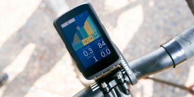
Expect no cell coverage for extended stretches. Carry a satellite communicator (SPOT, Garmin inReach, or similar) for emergency use. Let someone know your itinerary before departing.
Traffic on Narrow Sections
The Hogsback and other sections have minimal shoulders and RV traffic throughout the season. Ride defensively, wear bright colors, and consider timing your ride through the narrowest sections for early morning when traffic is lightest.
Weather Extremes
Afternoon thunderstorms are common in summer and can create dangerous conditions quickly. Lightning is a serious hazard on exposed ridges. If storms threaten, seek lower ground and shelter immediately.
Essential Gear Recommendations
The remote nature of Byway 12 demands careful equipment selection:
- Water Capacity: Carry minimum 100+ ounces (3 liters) capacity. Some cyclists add extra bottles or a hydration bladder specifically for this route.
- Sun Protection: Full-coverage arm sleeves, leg sleeves, high-SPF sunscreen, and a cap or visor under your helmet.
- Mechanical Supplies: Full repair kit including spare tubes, tire boot, pump or CO2, multi-tool, and chain quick links. Help may be hours away.
- Navigation: Downloaded offline maps are essential. Do not rely on cell-based navigation.
- Emergency Communication: Satellite messenger device strongly recommended.
- Clothing Layers: Temperature swings from Boulder Mountain to the desert floor can exceed 30 degrees. Arm warmers, a vest, and a light wind jacket are advisable.
- First Aid: Basic kit including electrolyte supplements, sunburn relief, and blister treatment.
Connect Your Adventure: Other Epic Mountain Routes
If Byway 12 captures your imagination, consider these other legendary cycling routes through America’s mountain landscapes:
Going-to-the-Sun Road in Glacier National Park offers a similarly dramatic mountain crossing with its own unique challenges and rewards. While the terrain differs from Utah’s red rock desert, the sense of accomplishment and the spectacular scenery make it a natural companion to any Byway 12 adventure.
For cyclists seeking additional challenging mountain terrain, routes through the Colorado Rockies, the Pacific Coast Highway’s mountain detours, and the Blue Ridge Parkway each offer their own distinct character while sharing the common thread of world-class cycling through America’s most dramatic landscapes.
Final Thoughts: Why Byway 12 Belongs on Your List
Utah Scenic Byway 12 is not the easiest cycling route you will ever ride. It demands respect, preparation, and a willingness to embrace discomfort. But for those who accept the challenge, it delivers an experience that transcends ordinary cycling.
The memory of riding the Hogsback ridge at dawn, with golden light catching the canyon walls below, stays with me years later. The sense of achievement upon completing the full route, knowing I had traveled through three of America’s most spectacular landscapes under my own power, remains one of my proudest cycling accomplishments.
This route reminds us why we ride: not for the easy miles, but for the moments that take our breath away, the challenges that force us to dig deeper, and the landscapes that remind us how small we are in the face of geological time. Utah Scenic Byway 12 delivers all of this and more.
Plan carefully, prepare thoroughly, and give yourself permission to stop often. The views deserve your full attention.

Stay in the loop
Get the latest cycle routes world updates delivered to your inbox.